Showing posts with label Irish. Gaelic. Show all posts

Monday, 23 May 2016

Children playing


Irish: "Tá na páistí ag súgradh sa tsráid"
English: The children are playing in the street.

In the above Irish sentence the word "súgradh" (pronounced "sugra") means "(act of) playing, sporting; amusement, flirting, having fun. This is a verbal noun of a verb that has no finite or participial forms. The Irish "súgradh" comes from the Old Irish "súgrad" with the same meaning. The etymology of this word is unknown. This word has no cognates outside of Gaelic (that I know of)...

Now in Serbian we have the word "igra" meaning "play, game". The verb "igrat", "igrati" means "to play, to dance, to have fun". This word comes from the Proto-Slavic jьgra and has cognates in all Slavic languages: 

Belarusian: ігра ‎(ihra)
Russian: игра ‎(igra)
Ukrainian: гра ‎(hra)
Bulgarian: игра ‎(igra)
Macedonian: игра ‎(igra)
Serbo-Croatian: игра (igra)
Slovene: igra
Old Czech: jhra
Czech: hra
Polabian: jagréića
Old Polish: igra
Polish: gra
Slovak: hra, ihra
Slovincian: gra
Upper Sorbian: jhra, hra
Lower Sorbian: gra, igra

The etymology of this word is unknown. This word has no cognates outside of Slavic languages (that I know of)...

Now are these two words related? I think so because in some dialects of Serbian we have another version of the word "igra": "sigra". This word also means "play, game". And the verb derived from this word is "sigrat", "sigrati" meaning "to play, to dance, to have fun".

So we have:

Slavic wide: "igra", "igrat"
Serbian only: "sigra", "sigrat"
Irish: "súgradh"

All meaning 

"play, game" and "to play, to dance, to have fun"

What do you think? Coincidence?


According to the latest archaeological data, Balkans and particularly the territory of today’s Serbia was a mayor Celtic (Gaulic) stronghold between the 4th and the 1st century bc. I wrote about this in my post "Bran - Vran". The genetic data from the Balkans is showing that the descendants of these Celts are still living in the Balkans, Slavicised and mixed with many other people into Serbians. Maybe this is why it is in the Serbian language that we find words like "sigra" which is the link between the Irish "súgradh" and the Slavic "igra"...

Thursday, 5 May 2016

Irij

"...the souls of our ancestors shine every morning from Iriy..." - "The book of Veles"

Ireland. Image courtesy Jacques Descloitres, MODIS Rapid Response Team at NASA GSFC

"Éire",is Irish for "Ireland", the name of an island and a sovereign state. It evolved from the Old Irish word Ériu, which was the name of a Gaelic goddess. Ériu is generally believed to have been the matron goddess of Ireland, a goddess of sovereignty, or simply a goddess of the land.

There are two theories that try to explain the origin of this word.

The first one says that the name Ériu is derived from the name other people gave to the island of Ireland. The second one says that the name originated in Ireland and was the name by which the Irish called their own land. They both have their proponents.

Ireland, the western most land theory

The first theory, which was proposed in the 19th century, and for which we read that it "does not follow modern standards of etymology", derives the name from Scottish Gaelic. According to this etymology, the origin of "Ériu" comes from ì (island) + thairr (west) + fónn (land), which together give ì-iar-fhónn, or "western isle". This is similar in meaning to the Norse name for Irish people, "west men". If we look at the map of Northern Europe, we can see that indeed Ireland is the land lying directly westward, looking from Scotland and from the Baltic sea, from which both Northern Slavic, Baltic, Norse and Danish mariners would have come to Ireland.  So Western Isle and West Men makes a lot of sense, but as we are told it "does not follow modern standards of etymology"...


Ireland, the fat, full, abundant land theory

The second theory, which apparently "follows the modern standards of etymology" says that the origin of "Ériu" comes from Proto-Goidelic "Īweriū" or "Īveriū" which comes from Proto-Celtic "Φīwerjon", which comes from from Proto-Indo-European "piHwerjon", which is related to "piHwer", which is supposed to mean "fat, full, abundant". This would suggest that the meaning of the word Ériu is "abundant land". The whole root chain here is reconstructed, meaning that we think the words in the chain might have existed, and might have the meanings we propose, and might have been related to each other, but we actually have no idea if this is true or not. On top of this, we don't know if the meaning "fat, full, abounding" is correct. Ireland is certainly not especially abundant compared to England or the rest of Europe. The land in Ireland is not in any way fatter or more fertile and more suited for agriculture, crop growth. In fact the opposite is the case which you can see from this map of land use in Europe.


You can see the distribution of the arable farmland (yellow), forest (dark green), pasture (light green), and tundra or bogs in the north (dark yellow). It is plain to see that Ireland does not deserve to be the only place named "fat, full, abundant land". The description of the quality of the Irish soil is best summarized on the web page called "Soils in Ireland" where the first sentence is "The general consensus is that Irish soil quality is good overall". So good, not great, not amazing. One thing that I would like you to note on the above picture is that Ireland is mostly light green, which is the color of pasture. The data found on the "Crops and Livestock Survey" for 2015 is (in thousands of hectares):

Area farmed 4,429.5
Total crops, fruit and horticulture 359.7
Total cattle and sheep production related land over 4,000

This means that most of the Irish agricultural land is used as pasture land. The reason why this is so is because the combination of the Irish climate which is wet and cold and the Irish soil which is acidic, makes Ireland best suited for growing grass, not agricultural crops. And hence Ireland is basically one huge grass field full of grazing cattle and sheep with few cold climate crops fields, forests and bogs strewn around. 

Anyway :)

One of the proponents of this modern scientific "fat, full, abundant land" theory is John Koch. In his work "Celts, Britons, and Gaels—Names, Peoples, and Identities" he provides a detailed discussion on the subject, which is intended to prove the theory. Here is what he says:

"...The Irish as ‘them’ are first recorded as Latin derived from Greek Iernoi Īernī. Later, is recorded more correctly as Iouernoi Īuernī. The first occurrence of Īernī probably goes back to a Coastal Itinerary of Marseille of the sixth century BC. In both instances, the name of the people Īuernī is derived from the place-name found in classical sources as Īueriō. Īueriō is none other than the Primitive Irish forerunner of Old Irish Ériu, Modern Éire. The etymological sense of the word is ‘the Fat’ or ‘Fertile Country’. Ériu, genitive Érenn, corresponds to Welsh Iwerydd ‘Irish Sea, Atlantic’ and Iwerddon ‘Ireland’. The ancient Celtic forms behind these are the nstem nominative *Īweriū, genitive *Īwerionos. In the Antonine Itinerary, a Latin source of the early 3rd century AD, we find Insula Clota in Hiverione. Dative Īveriōne implies nominative Īveriō ‘Ireland’, thus directly reflecting the Primitive Irish nom. *Īweriū. Thus the Indo-European preform would have been  *piHwerjōn ‘The Fertile Land’. I proposed that the ethnonym Īuernī proves that Irish—or the Celtic language that was to become Irish was spoken in Ireland already at the time that the Greeks first heard of the place in the 6th century BC. More recently, Patrick Sims-Williams has doubted this conclusion. Instead, he argues that Īueriō and Īuernī could have been names in use by Celtic speaking peoples on the European mainland for an Ireland that was not yet itself Celtic speaking.  I do not think that this alternative is plausible, for the following reasons. Not only were Īueriō and Īuernī in use in what was Ireland’s Final Bronze Age or Dowris II and not only are they Celtic names, but they have also survived in the Irish language of literate, historical times. Īuernī, the name that the Greeks borrowed, survives as Old or Middle Irish Érainn, a name which not only exists in Irish, but exists in no other Celtic language except Irish. In medieval Irish literature Érainn is used for tribal and dynastic groups in Munster and elsewhere. The groups in question are marginal within historical times, but credited with having ruled the prestigious royal site of Tara in remote antiquity; so the name is stratified deeply within Irish-language Irish tradition itself and occurs nowhere else in the Celtic world. Furthermore, the place-name Ériu has, as a byform, a common noun Old Irish íriu, meaning ‘earth, land’. There is no corresponding word from Brittonic or Continental Celtic. In other words, Ériu is explicable has having arisen out of the semantics of Irish in particular, rather than Celtic in general. Furthermore, names derived from the same root as Ériu have survived prominently as submerged eponyms in the Irish origin legends of Lebar Gabála and related texts. These include the prominent Milesian invaders Iär and Íth. The latter’s name simply means ‘fat’. The connection of the name Iär to Éire and Érainn is not at all apparent within the literate period. But *Īueros, the pre-form of Iär, would have been an obvious eponym for Īueriō in the Primitive Irish of prehistoric times... Īueriō was known to mean the ‘Fat Land’, which was no longer so for the writers of Lebar Gabála...."

Convinced? Lets have a look at the highlighted parts. 

"...Ériu, genitive Érenn, corresponds to Welsh Iwerydd ‘Irish Sea, Atlantic’ and Iwerddon ‘Ireland’..."

If you are in Wales and you look directly westward, what you see on a clear day is: Ireland. So Ireland is the land in the west. And after Ireland, further west is the Atlantic ocean, the western sea. Or maybe the Irish sea and Atlantic got their name from Ireland.

"....Īueriō was known to mean the ‘Fat Land’, which was no longer so for the writers of Lebar Gabála.... "

Ok, this is strange. Īueriō is a word with an unknown meaning and so we proposed that it means "Fat Land" based on a completely derived etymology linking it to the derived PIE root "piHwer" which is supposed to mean "fat, full, abundant". Now it is " known to mean Fat Land"? The old Irish "íriu" which was supposed to have been derived from Īueriō, means "land, earth, soil; the earth, the world". Not "fat, full, abundant land". And if the meaning "fat, full, abundant land" was not known to the users of the word "íriu" in the Irish annals, maybe it is because this word never actually meant "fat, full, abundant land" but just "land, earth, soil; the earth, the world"....

But this part is the most interesting.

"...Érainn, a name which not only exists in Irish, but exists in no other Celtic language except Irish....Furthermore, the place-name Ériu has, as a byform, a common noun Old Irish íriu, meaning ‘earth, land’. There is no corresponding word from Brittonic or Continental CelticIn other words, Ériu is explicable has having arisen out of the semantics of Irish in particular, rather than Celtic in general..."

Maybe the word "íriu" doesn't exist in other Celtic languages, but it exists in Slavic languages.

Iriy, Irij or Vyriy (Russian: ирий, ирей, вырий) is a mythical place in Slavic mythology where birds fly for the winter and souls go after death, sometimes identified with paradise. The term was first mentioned in the writings of Vladimir II Monomakh. During the Christianization of Kievan Rus', people were able to imagine heaven and hell based on the idea of Iriy. By the way Viriy is just v + iriy = in, into + iriy. Question: where do the souls of the dead people go? V Iriy = Into Iriy.

I know what you will say. This Slavic Iriy can be any place and surely the words similarity is a coincidence. But there is more. Slavic mythology tells us more about Iriy in the story about Jarilo: 

"Up until the 19th century in Russia, Belarus and Serbia, folk festivals called Jarilo were celebrated in late spring or early summer. Early researchers of Slavic mythology recognized in them relics of pagan ceremonies in honor of an eponymous spring deity. In Northern Croatia and Southern Slovenia, especially Bela krajina, similar spring festivals were called Jurjevo, nominally dedicated to St. George, and fairly similar to the Jarilo festivals of other Slavic nations.

All of these spring festivals were basically alike: processions of villagers would go around for a walk in the country or through villages on this day. Something or someone was identified to be Jarilo or Juraj: a doll made of straw, a man or a child adorned with green branches, or a girl dressed like a man, riding on a horse. Certain songs were sung which alluded to Juraj/Jarilo's return from a distant land across the sea, the return of spring into the world, blessings, fertility and abundance to come.

Jarilo was a son of the supreme Slavic god of thunder, Perun, his lost, missing, tenth son, born on the last night of February, the festival of Velja Noć (Great Night), the pagan Slavic celebration of the New Year. On the same night, however, Jarilo was stolen from his father and taken to the world of the dead, where he was adopted and raised by Veles, Perun's enemy, Slavic god of the underworld and cattle. The Slavs believed the underworld to be an ever-green world of eternal spring and wet, grassy plains, where Jarilo grew up guarding the cattle of his stepfather. In the mythical geography of ancient Slavs, the land of the dead was assumed to lie across the sea, where migrating birds would fly every winter. This land of the dead was by Slavs known as Iriy, Irij or Vyriy (Russian: ирий, ирей, вырий).

With the advent of spring, Jarilo returned from the underworld, that is, bringing spring and fertility to the land. Spring festivals of Jurjevo/Jarilo that survived in later folklore celebrated his return."

So...Wet, ever green land of eternal spring, full of cattle which lies across the sea and is called Iriy...

This is a typical picture from Ireland. What do you see on it? Ever green land of eternal spring, full of cattle, which lies across the sea. Is there better description of Éire, Ireland?


I have been living in Ireland for past 21 years. It snowed properly once. And we had one proper summer month. The rest of the time it was a perpetual wet spring. 

So is Īueriō, Iriu, Éire Slavic Iriy? I believe so, because believe or not there is actually no other place in Europe that fits the description. It is Ireland's unique position in the north of Europe and in the middle of the Golf stream that gives it unique climate ideal for growing grass and which makes it a paradise for cattle herders. 

And this is why the ancient Irish society was based around cattle. Cattle was wealth, cattle was currency, cattle was what people fought for. Even the main Irish heroic myth, "Táin Bó Cúailnge" is a description of a cattle raid...

Now interestingly the god that stole Jarilo, the young sun, and who took him to the land of the dead, Iriy, was called Veles, but who was also known as Volos. In Serbian, the word Vo, Vol means bull. So Volos would actually be "Cattle god". A very good name for a good that rules over Iriy, Īueriō, Iriu, Éire...Funnily enough in Irish the word for cattle is Bó which in Serbian means to stab, like with a horn. There is a whole cluster of words based on this root in Serbian and Irish. But not just the words for cattle are the same in Serbian and Irish. Serbians from Bosnia managed to preserve ancient bull fighting described in "Táin Bó Cúailnge". 

Bull fighting, Bosnia
I wrote about the common Irish and Serbian words and customs related to cattle in my post "Bó - Vo"

The obsession with cattle and viewing cattle as the main source of wealth was also the same in Serbian and Irish society. In Serbian language one of the old words for cattle was "blago" which literally means "treasure, wealth". So a green land, where grass never stops growing, ideal for growing cattle, must have looked like paradise for cattle herders. And guess what. The word for paradise in Slavic languages is "Raj" (pronounced ray), which is very very similar to the word for otherworld "Iriy". As a matter of fact we can get the word Iriy (which has no known etymology) from Je Raj (pronounced ye ray) meaning "is paradise". 

Slavic word "raj" meaning paradise comes from the Proto Slavic: "rajь" - paradise. This is an ancient word because the cognates include 

Avestan, Old Persian: ‎"rāy" - paradise, wealth and 
Sanskrit: रयि ‎(rayi) - rich, property, goods, possessions, treasure, wealth, house, stuff, materials
Proto-Italic: "reis" - thing, matter. Originally, the noun was a "regular" i-stem, and would have been *rēj- before vowels (genitive *rējes, dative *rējei etc.), and *rēi before consonants and word-finally (nominative *rēis, perhaps originally disyllabic). In the former, -j- was regularly lost, while in the latter the diphthong was shortened before another consonant, due to Osthoff's law.

Apparently these are the only descendants of the Proto-Indo-European *reh₁ís ‎meaning “wealth, goods”

If for our ancestors "raj" paradise was a place of wealth, and the greatest wealth was cattle, then the land of cattle was indeed a paradise "je raj" = "iriy". 

Was that paradise Īueriō, Iriu, Éire? Was the original meaning of the word "land rich in cattle" rather than "fat land"?

There are two worlds, the world of the living and the world of the dead. The sun spends the day in the world of the living and the night in the world of the dead.
And there are two gates that stand on the border between these two worlds: the eastern gate and the western gate. 
Every morning the eastern gate is opened by Danica, the day star, which is in the morning called Zornjača, the morning star, and the sun comes from the world of the dead into the world of the living. 
And every evening the sun goes from the world of the living into the world of the dead through the western gate, which is then closed behind him by Danica, the day star, which is in the evening called Večernjača, the evening star. 
The souls of the dead follow sun to the western gate, which is where the entrance into the land of the dead is. 
And there they enter Iriy, the ever green land of eternal spring, full of cattle, raj, paradise. And every morning, when the eastern gate of the world of the dead is opened, they smile on us...


Tuesday, 16 February 2016

Dún Ailinne

In my post about the etymology of the word Alps I talked about the Gaelic word "ail" meaning stone, rock, cliff. This post is about a place whose name is derived from the word "ail": Dun Ailinne.

Dún Ailinne is an ancient ceremonial site on the hill of Cnoc Ailinne in County Kildare, Ireland. It is southwest of Kilcullen, near the N78 road to Athy. 


The site is circular, about 13 ha (32 ac) in area, ringed by an earth bank and ditch (or "henge"). As with most henges, the ditch is on the inside, meaning that it was likely to have been symbolic rather than defensive. It is believed that Dún Ailinne was a royal centre and inaugural or ceremonial site for the Kings of Leinster. In terms of its ritual use, the internal structures and layout, and its location and association, is similar to the other royal sites of Tara, Navan Fort and Rathcroghan. Indications of earliest use are from the Neolithic period, but the main activity there was during the Iron Age. It does not seem to have been dwelt in year-round, but was instead mostly used for short-term activity, including ritual. It seems to have been occupied during the Spring/Summer months and there is evidence of cooking, which include a great deal of bone from cows, sheep, pigs, deer and horses. In 1968 a caesium magnetometer survey and a resistivity survey was undertaken that highlighted an area in the low mound, later revealed as areas of intense burning. A La Tène style sword and Roman bronze fibulae have also been found at the site. The artefacts suggested intense activity in the Iron Age and/or Early Medieval period that disturbed a Neolithic occupation phase. While it figures in some early historical references, Dún Ailinne was mostly abandoned about the time the nearby early Christian settlement at Old Kilcullen was established in the 6th century.

This is a drawing showing the results of the geophisical survey of the site. You can see various overlapping features dating to different time periods. 


The images below show a time-lapse sequence of the summer solstice sunset as observed from Dún Ailinne. You can see that the sun touches the top of the Dunmurry hill, and it then proceeds to slide down the side of it, until it finally disappears behind the hill.


What is interesting is that right in front of the Dunmurry hill lies the Long hill, an elongated hill aligned roughly East-West and orientated on a slight E-SE to W-NW axis. On top of that hill lies the Long hill cursus.


Cursus was a name given by early British archaeologists such as William Stukeley to the large parallel lengths of banks with external ditches which they thought were early Roman athletic courses, hence the Latin name cursus, meaning "course". Cursus monuments are now understood to be Neolithic structures and represent some of the oldest prehistoric monumental structures of the British Isles. Long hill Cursos is by some believed to be approximately 1.5km. long and almost 100m. wide, but it is more likely for it to have been just over a kilometre long and approximately 50 metres wide. The OSI map also records clusters of barrows at each end of the Cursus - Cluster 'E' at the W-NW end and Cluster 'F' at the E-SE end (Ref. Pádraig Clancy's study of the ancient monuments of the Curragh).

If we extend the side of the Dunmurry hill along which the sun slides on the eve of the Summer solstice, it touches the east - south east end of the Long hill cursus, while the vertical going through the top of the Dunmurry hill touches the west - north west end of the Long hill cursus.


It seems that the Long hill cursus was deliberately built to create the sacred triangle visible from the Dún Ailinne. In which case Dún Ailinne was not just any ceremonial site but a solar observatory and solar temple. I already wrote about ancient henge solar observatories and solar temples in my post about Henges - Rondel enclosures. The henge was dug to mark the solar observation circle and there was probably a tall stake or a tall standing stone standing somewhere inside the henge circle working as a gnomon. The shaddow cast by the gnomon stone at sunrise was used to determine the exact date. The fact the sun also performed the gliding, or rolling down the Dunmurry hill on the eve of the summer solstice, just made the Dún Ailinne more special. Is there a proof that there was once such a standing stone in Dún Ailinne? There is.

A verse in the Dindsenchas mentions how Dún Ailinne/Alend acquired its name:

Three mighty men made essays of trenchings,
Burech, Fiach, and Aururas:
it is they who without flagging (clear fact!)
dug the rampart of Alend.

Buirech cast from him straightway
across the rampart(no weakling he!) -
a stone he cast from his spear-arm;
and that is the ail in Alend.

This seems to suggest that Buirech placed the Ail (Stone) standing upright on a mound, inside the henge (trenching) that sat at the summit of the Cnoc Ailinne.

Today you will see three very large boulders on the summit, two look like limestone boulders (although it's possible they're both very weathered granite) and an elongated white granite boulder. John O'Donovan's survey of Dún Ailinne in 1837 records only "two rough mountain boulders of considerable size. One of these might be the Ail mentioned in the Dindseanchus as placed in the mound by the hero Buirech......". O'Donovan also records a scattering of stone debris on the summit which he interpreted as a "fort.......much effaced", but Estyn Evans suggests this scatter of stone and the large boulders may have been the remnants of a Neolithic/Early Bronze Age cairn. I would say that the scattering of stones and the remaining boulders are all parts of the original gigantic standing stone after which the Dún Ailinne got its name, and which was deliberately destroyed, possibly during the early Christianization of Ireland and maybe even later.

The images below show the large boulders that now sit on the summit of Dún Ailinne.There'sisible line of drill holes in the large elongated white granite boulder. You can clearly see weathering on one side,but the opposite side shows areas which look significantly fresher,which could suggest it was deliberately broken in recent times. Was this boulder part of a much larger monolith?


Is this what Dún Ailinne might have looked like once?


In Gaelic the word "dún" doesn't only mean military fortification. It means to shut, to close, to enclose, enclosure, fort, fortress, place of refuge, haven, haven for ships, residence, house, promontory fort, bluff...So any enclosed place probably including henge.

In Gaelic the word "ail" means stone, rock.

And in Gaelic the word "linn" means time, period, generation, course.

If there is a possibility that Dún Ailinne was once used as a solar observatory, solar calendar, with the central rock pillar (ail) inside of a henge (dún) and which was used to determine the day of the Summer solstice, the beginning of the solar year, the beginning of a new solar cycle, the new "time period" (linn) is it possible that the name Dún Ailinne actually means "The enclosure of the time stone", the solar calendar?

I would like to thank "bonedigger" for all his great work in exploring Irish megalithic sites and drawing public attention to their possible astronomical features. 

1. Dún Ailinne's Role in Folklore, Myth, and the Sacred Landscape
2. Dún Ailinne, Knockaulin Td and 2. Glebe North Td, Co. Kildare E79 - Unpublished excavations

Monday, 15 February 2016

Alps

The Alps (Italian: Alpi; French: Alpes; German: Alpen; Slovene: Alpe) are the highest and most extensive mountain range system that lies entirely in Europe, stretching approximately 1,200 kilometers (750 mi) across eight Alpine countries: Austria, France, Germany, Italy, Liechtenstein, Monaco, Switzerland and Slovenia. 


But these are not the only Alps in Europe. In The Balkans we find Dinaric mountains known also as Dinaric Alps. This mountain range stretches along the Eastern Adriatic coast across Albania, Serbia, Montenegro, Bosnia, Croatia and Slovenia. The highest peaks of the whole range are in the southern end which lies in Montenegro, Serbia and Albania. 


The English word alps comes from the Latin alpes which comes from Latin albus ‎meaning white. Latin albus, is said to come from Proto-Italic *alβos meaning white.

The official etymology says that we don't really know where the original word comes from.

Basically we have two theories.

First theory proposes a Proto-Indo-European root for the word Alps. It says that the Proto-Italic *alβos is derived from Proto-Indo-European *h₂élbʰos, *álbʰos, *albʰós ‎meaning white. Cognates include Umbrian ‎alfu meaning white, Ancient Greek ἀλφός ‎(alphós) meaning whiteness, white leprosy and Hittite alpas meaning cloud.

Second theory proposes non-Indo-European origin. According to the English Etymological Dictionary, the Latin Alpes might possibly derive from a pre-Indo-European word *alb "hill, mountain". This theory then proceeds to propose that this supposed  pre-Indo-European word is the root of many Albania mountain areas: Balkan Albania, Caucasus Albania and Scottish Albania (Alban). 

I would like to propose another theory: The word Alps comes from Gaelic and means "white stones, white cliffs, white peaks".

The first clue that the word Alps could be of a Gaelic (Celtic) origin can be found in a comment made by Maurus Servius Honoratus, a late fourth-century and early fifth-century grammarian, who in his time had a reputation of being the most learned man of his generation in Italy. He said in his commentary on Virgil (A. X 13) that: "all high mountains are called Alpes by Celts".

The second clue is the fact that in Latin the word "albus" is used primarily to mean "white" that is dull or matte which would mean more grayish white than bright shining white.

The third clue is the fact that in Ancient Greek the word ἀλφός ‎(alphós) means whiteness, white leprosy, lichen white, again grayish white, not bright shining white.


The fourth clue is that the German word Alp or Alm (meaning "seasonal high mountain pasture", from Old High German alpa, alba) was originally identical to the name of the Alps (German Alpen) itself.

Have a look at these two pictures.

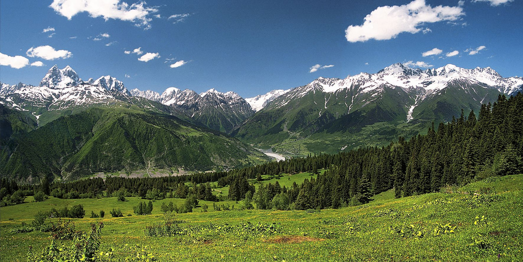
Alps (grayish white rocks towering over green high mountain pastures)


Dinaric mountains (Alps) (grayish white rocks towering over green high mountain pastures)


So what does this have to do with Gaelic?

In Gaelic we have this cluster based on the root word ail - stone, rock:

aill, -e, pl. id., and ailltreacha (Aran), f., a cliff, a rock; cf., an Áill, the "Naul" Co. Dublin (also faill, f., bárr na faille, the top of the cliff).
ailleort - high-rocked; from ail, rock
aill-bhruachach - having steep or rocky brinks. 
ailleadóir- cliff-climber.
ailbhinn - flint, precipice; from ail - rock.

From the same root ail - large stone, rock we have this word:


ailp, pl. alpa - a protuberance, a huge lump, a high mountain; a stout person

In Gaelic we also have this word:

bán - white which comes from Proto-Indo-European "bʰeh₂-" meaning - "white", "shining"

From these two words ail and bán we can make the construct: 

ail bán - alban - rock white - white rocks, white peaks, high mountains

What is also very interesting is that in Irish  the word "ailbh" means "flock, heard, drove".... Is this word derived from the fact that flocks, herds were driven up to the mountain pastures, ailban, alpen, alps, every summer? This is a high mountain pasture from Slovenian Alps.


In A.D. 875 Scotland was still known under its Roman name: Caledonia. Caledonia was in turn divided among the following lands: the Kingdom of Alban, the Northern Islands, and the Borders, which include the Kingdom of Strathclyde, Galloway, and the northern portions of the Kingdom of Northumbria. 


The kingdom of Alban lied mostly along the great Grampian Mountains. These are highland pastures lying under the great Grampian Mountains:


This is a picture of the highland pastures under the Matterhorn peak, Valais Alps, Switzerland.


Do you see any similarity? High pastures with grayish white rocky peaks?

Alba is the Scottish Gaelic name (Pronounced Alpa) for Scotland. It is cognate to Alba (gen. Albann, dat. Albainn) in Irish and Nalbin in Manx, the two other Goidelic Insular Celtic languages, as well as words in the Brythonic Insular Celtic languages of Cornish (Alban) and Welsh (Yr Alban) that also, in modern practice, are the Goidelic and Brythonic names for Scotland; although in the past they were names for Britain as a whole, related to the Brythonic name Albion. The term first appears in classical texts as Ἀλβίων Albíon or Ἀλουΐων Alouíon (in Ptolemy's writings in Greek), later as Albion in Latin documents. Historically, the term refers to Britain as a whole. Is this name derived from the appearance of the white cliff of Dover, which is the first thing anyone crossing the Channel and approaching Britain would see? So when Gaels first approached Britain, and they was the white cliffs, they would have probably named the land they were about to land on "ail bán" = white cliff land. And if later a Greek traveller crossing into britain asked the Gaelic speaking natives what was the name of this new land (pointing at the white cliffs), they would probably tell him "ail bán" = white cliff? And hey presto, we have a name for this new land of white cliffs...(Thank you Tim for pointing this to me)


Gaelic speakers in Scotland used Alba (dative Albainn, genitive Albann, now obsolete) as the name given to the former kingdom of the Picts which lied along the Great Grampian Mountains, which is full of white greyish white rocky peaks covered in snow. Did the name originally just mean "white peaks", "the land of white peaks"? Not too many of those in Ireland, so it must have been some sight for the invading Gaels. So a fitting name for the new foreign land...

In the High Medieval period Alban became re-Latinized as "Albania". This latter word was employed mainly by Celto-Latin writers, and most famously by Geoffrey of Monmouth. It was this word which passed into Middle English as Albany, although very rarely was this used for the Kingdom of Scotland, but rather for the notional Duchy of Albany.
So is Gaelic ail bán - Alban - rock white - white rocks the root of the word Alpen, Alp? What is the relationship of this phrase and the Latin albus, Ancient Greek ἀλφός ‎(alphós) and Hittite alpas? Are they related at all? Is the Gaelic phrase the root of all these other words? Or is all this just a coincidence?

Is it possible that by the early Iron Age, the expression "ail bán", or some of the dialectal versions of this expression, entered Ancient Greek and Latin from Gaelic, or some other dialect of Celtic languages, in the meaning of white cliffs, white rocks, white peaks? And is it possible that this is why Greeks and Romans named the region lying along the Greater Caucaus - Albania?

Caucasian Albania (Latin: Albānia, Greek: Ἀλβανία, Albanía, in Old Armenian: Աղուանք Ałuankʿ (Aguank), Parthian: Ardhan, Middle Persian: Arran; Georgian: რანი, Rani); is a name for the historical region of the eastern Caucasus, that existed on the territory of present-day republic of Azerbaijan (where both of its capitals were located) and partially southern Dagestan. The territory lies on the southern part of the Greater Caucasus range.


Caucasian mountains (grayish white rocks towering over green high mountain pastures)


-ia is a word-forming element in names of countries, diseases, flowers, from Latin and Greek -ia, which forms abstract nouns of feminine gender. In paraphernalia, Mammalia, etc. it represents the Latin and Greek plural suffix of nouns in -ium or -ion. 

So Albania is Alban + ia = ail + ban + ia = the land, country of white clifs, white peaks = Greater Caucasus

And it is the same with the Balkan Albania, which only appeared in records in Early Medieval time. The highest peaks of the Dinaric range are found in its southern part which lies in Montenegro, Serbia and Albania. Viewed from the coast, you see giant rocky peaks covered with snow looming over green pastures. So was Albania used here just as a name for the land of white cliffs, white peaks?


Let me know what you think about all this.